This 14-day all-inclusive expedition blends a classic Langtang Valley trek with a guided ascent of Yala Peak. Designed for adventurous trekkers with good fitness, it requires no technical climbing experience. You'll journey from Kathmandu into the heart of the Langtang region, acclimatize properly, receive essential mountaineering training, and make a pre-dawn summit push for a sunrise you'll never forget. The return journey allows time to celebrate your achievement before departing.
Yala Peak Climbing - 13 Days
Highlights of Yala Peak Climbing
- Embark on an unforgettable journey into the heart of the Himalayas with non-technical Yala Peak (5,500 m), the ultimate introduction to mountaineering.
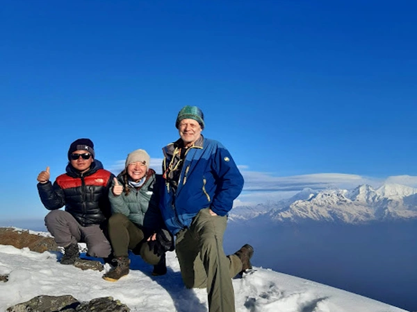
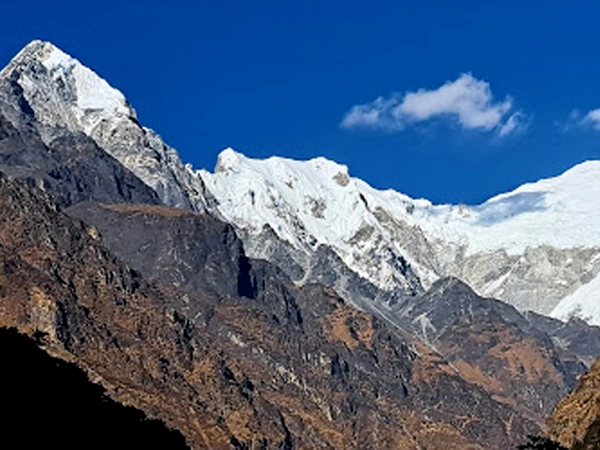
- Stand atop the summit (5,500m) and be captivated by a spectacular 360-degree panorama, where majestic colossi like Langtang Lirung (7,234 m), Shishapangma (8,027m) in Tibet, and Dorje Lakpa stretch across the horizon.
- Delve into the vibrant cultures of the Tamang and Tibetan people, experiencing their rich traditions firsthand.
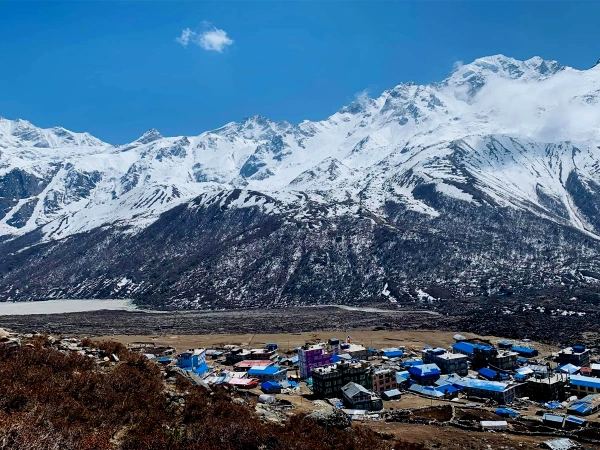
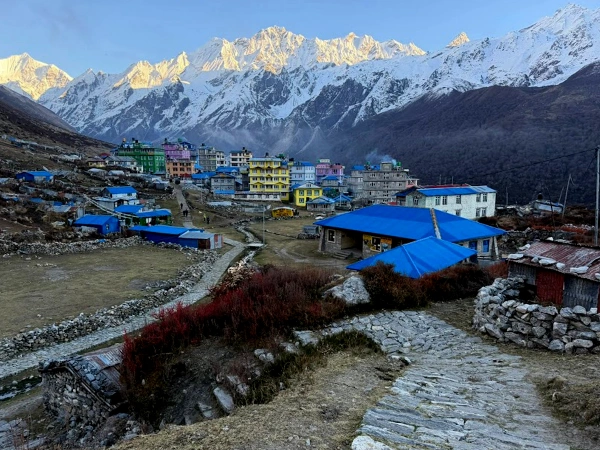
- Explore ancient monasteries, including the serene Kyanjin Gompa, steeped in history and hospitality.
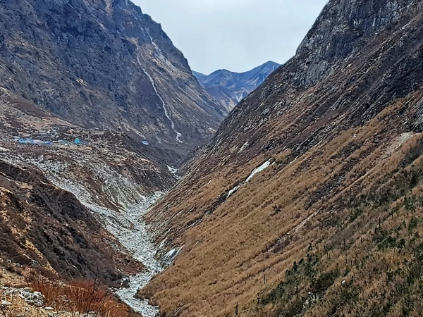
- Trek through the untouched beauty of Nepal's Langtang National Park, a haven for wildlife and breathtaking landscapes.
- No previous climbing experience is required; you'll receive engaging "Learn as You Climb" hands-on training at the Yala Base Camp, ensuring you're well-prepared for the adventure ahead.
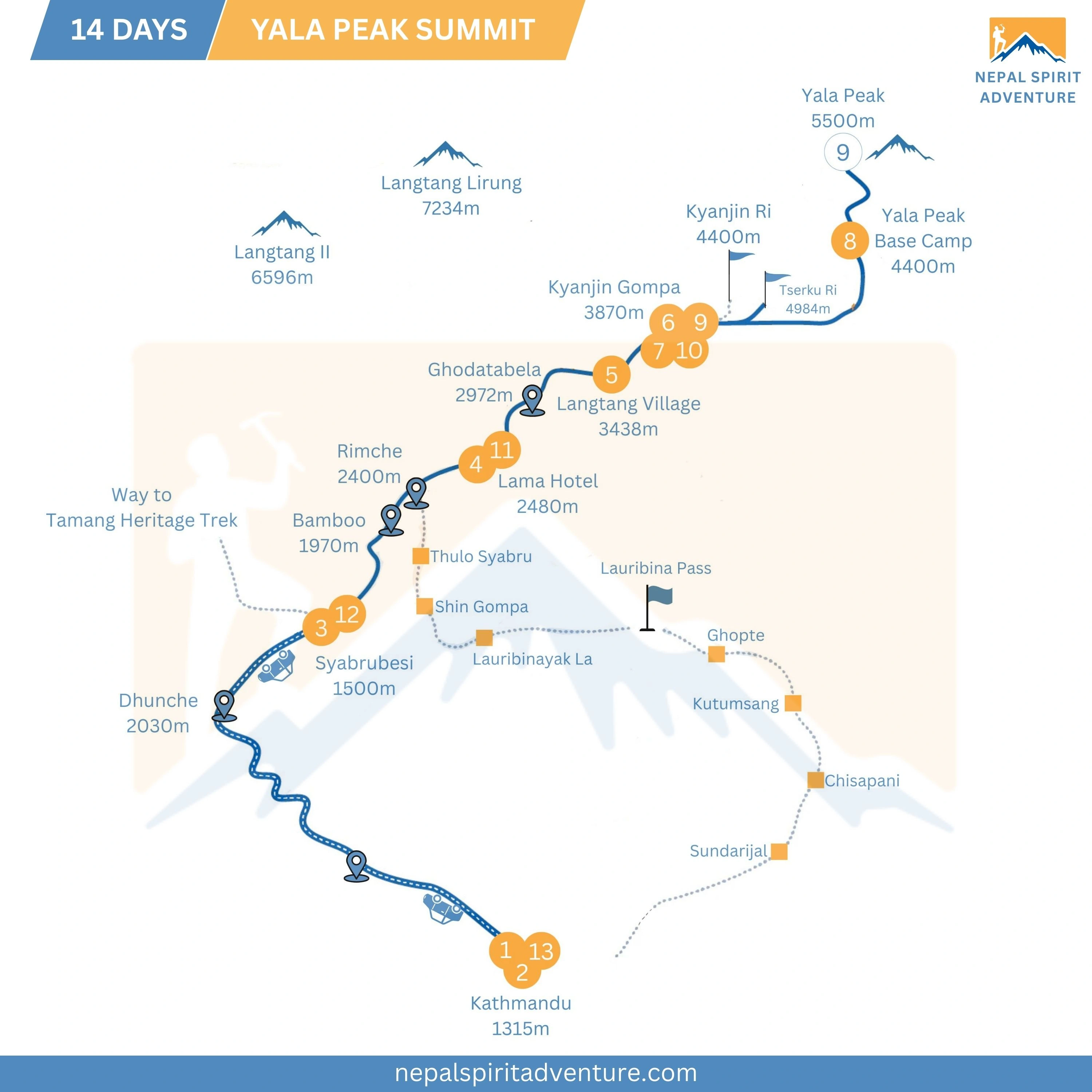
- Our thoughtfully crafted itinerary features dedicated acclimatization days at Kyanjin Gompa, allowing a comfortable adjustment to the altitude.
- Enhance your summit success with a rewarding acclimatization hike to Kyanjin Ri/Tserko Ri, setting the stage for an exhilarating ascent.
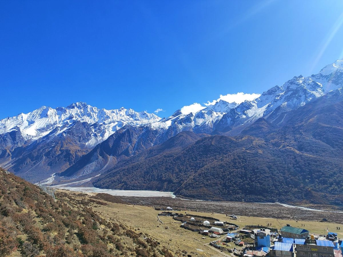
Have you ever dreamt of standing atop the pinnacle of the world, gazing in awe at the giants of the Himalayas, yet thought that mountaineering was reserved for the extreme few? Yala Peak climbing is the answer to that dream. Nestled in the breathtaking Langtang Valley, this magnificent peak soars to 5,500 meters (18,044 feet), offering the perfect gateway to the exhilarating realm of high-altitude adventure.
Often hailed as the quintessential "trekking peak", Yala promises a non-technical climb that prioritizes the raw experience of the Himalayas over complex, intricate rope work. The voyage to the Yala Peak is merely a summit push; it is an immersive experience that interweaves the rich culture of ancient Tamang villages and serene Buddhist monasteries with the exhilarating thrill of a pre-dawn ascent. From the summit, you are rewarded with a breathtaking panoramic spectacle that few are fortunate enough to witness: the majestic Langtang Lirung (7,234 m), the icy expanse of the Gangchempo range, and even the resplendent white pyramid of Shishapangma (8,027 m) across the border in Tibet. It is no surprise that most of the Everest climbers choose to start with the Yala Peak to acclimatize to high altitude.
Whether you are an experienced trekker looking to take the next step or a passionate adventurer with a good level of fitness, the Yala Peak expedition is your most accessible route to becoming a mountaineer. With expert Sherpa guides accompanying you, comfortable teahouse lodging for most of the trek, and comprehensive on-site training, we turn the impossible into the achievable. The odyssey to the Yala Peak is more than just a climb; it is the beginning of your remarkable Himalayan story.
How difficult is Yala Peak Climbing? Can I do it with no prior mountaineering experience?
Yala Peak is celebrated as one of Nepal's most approachable "trekking peaks". It is classified as non-technical, meaning that climbers won't need to navigate steep, icy walls with fixed ropes. Instead, it's categorized by the Nepal Mountaineering Association as a "hiking peak". While it is non-technical, it is still a high-altitude endeavor. Fortunately, we provide comprehensive on-site training at Yala Base Camp, where you can learn the essential skills on how to use crampons and ice axes, so prior experience is not required-just a good level of fitness and a sense of adventure.
How fit do I need to be? What training do you recommend?
To tackle Yala Peak, you should be in good physical condition and possess solid cardiovascular endurance. You should be prepared to trek for 6-7 hours a day on consecutive days, traversing both uphill and downhill terrains. Think of this adventure as a high-altitude hike rather than a technical rock climb. We recommend starting a training regimen at least a month before your trip, focusing on the following aspects:
- Cardio: Engage in running, swimming, cycling, or brisk walking to build your stamina.
- Strength: Concentrate on exercises that enhance your leg and core strength, such as squats and lunges.
- Practice: Undertake weekend hikes with a lightweight backpack to further condition your body for the journey ahead.
What is the success rate for summiting Yala Peak?
For climbers who are properly acclimatized and maintain good fitness, the success rate for the Yala Peak is remarkably high, often estimated at around 95%. Our meticulously curated itinerary is specially designed with built-in acclimatization days (like the hike to Kyanjin Ri and the stay at Kyanjin Gompa) to maximize your chance of standing on the summit.
What permits do I need for Yala Peak Climbing?
Rest assured, your climbing package includes all necessary permits, alleviating any concerns about the paperwork. This encompasses the Langtang National Park Entry Permit, and since Yala Peak is classified as a trekking peak, no special climbing permit is required from the Nepal Mountaineering Association. We take care of all of the logistical details for you.
Can I trek solo or independently to climb Yala Peak?
Unfortunately, regulations now prevent solo or independent trekking in the Langtang region for foreign trekkers, mainly due to safety and security considerations. It is mandatory to be accompanied by a licensed guide. This requirement is actually a significant benefit- our expert guides not only navigate the route and manage logistics, but also ensure your safety throughout the journey.
What is the accommodation like? Will I be camping the whole time?
You get the best of both worlds on this journey! During the majority of the trek (Days 1-5 and 8-14), you will enjoy cozy stays in traditional teahouses and lodges. These provide a warm bed, delicious meals, and a wonderful opportunity to connect with local culture. However, for the one memorable night at Yala Base Camp (Yala Kharka), you'll experience a true mountaineering ambience with tented accommodation. Our dedicated staff will set up sleeping, dining, and kitchen tents, where you can enjoy your meal with stunning mountains surrounding you at a height.
When is the best time of year to climb Yala Peak?
The ideal times for climbing Yala Peak are during the Spring (March to May) and Autumn (September to November)
- Spring (March to May): During this season, the weather is stable, the temperatures are pleasantly warm, and the hillsides are bursting into a vibrant display of rhododendron flowers.
- Autumn (September to November): This period offers crystal-clear skies, providing breathtaking mountain views, and dry trails perfect for trekking.
- Climbing in Winter (December-February) is possible, but it comes with extreme cold temperatures and a high risk of snow, which can hinder the summit attempt.
What kind of cultural experience can I expect?
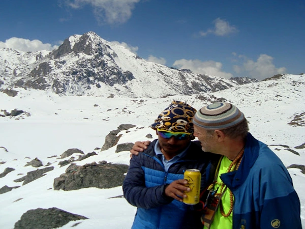
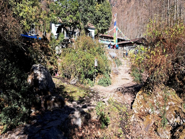
The journey to Yala Peak is as enriching culturally as it is physically. You will traverse the stunning landscapes of the Langtang Valley, home to the warm and welcoming Tamang and Sherpa communities. Along the way, you'll visit age-old Buddhist monasteries, explore traditional stone-built villages, and witness the colorful prayer flags and intricately stacked mani walls. This trek offers a profound insight into the vibrant Himalayan Buddhist culture, providing an unforgettable experience that blends adventure with tradition.
Trip Gallery


Short Itinerary
Your Arrival in Kathmandu Tribhuvan Airport
In Kathmandu, Trip Preparation
Kathmandu to Syabrubesi by Bus, approx. 122 km 7-8hrs
Approx. 6-7hrs Trek to Lama Hotel 11-12 km
Trek to Langtang Village, Approx. 5-6hrs 14-15 km
Langtang Village to Kyanjing Gompa 4hrs trek, 7 km
Climb up to Tserku Ri 7-8hrs Walk, 11-12 km
Kyangjin Gompa to Yala peak Base camp 4-5 hours, 6-8 km
Summit Yala Peak, trek back to Kyangjin Gompa 12-14 hours,
Trek back to Lama Hotel 6-7 hours, 16-18 km
Trek to Syabrubesi 10-12 km, 4-5 hours
Drive back to Kathmandu approax 122km, 7-9 hours
Final departure
Yala Peak Climbing - 13 Days Itinerary
Your Arrival in Kathmandu Tribhuvan Airport
Upon arrival in Nepal, Tribhuvan International Airport, Kathmandu. You'll be met by our tour officer, then he escort you to the hotel (prime location). Overnight at the hotel in Kathmandu. If your Kathmandu flight is in the day, you can explore the Thamel bazaar and enjoy walking in the old town of Kathmandu.
In Kathmandu, Trip Preparation
It would be the best itinerary to take a rest-acclimatization in Kathmandu before heading to the Langtang Valley trek and Yala peak Climbing because most of the international flights to Kathmandu are at night, and the second stay in Kathmandu makes your trip best and successful. Enjoy breakfast at the hotel, which is included, then meet with the guide, and we can discuss the trip details. Check your trekking and climbing equipment. If you do not have it, buy or rent it from the equipment shops that are available. Overnight in the hotel!
Option:
You can explore the Kathmandu city local tour: Kathmandu Durbar Square, known by Basantapur/Hanuman Dhoka Kumari Temple (the living goddess), Swoyambhunath Stupa, also known as Monkey Temple, Pashupatinath Temple, and Bouddhanath Stupa. While visiting these monuments, you'll learn about Nepali culture, history, beliefs, art, and architecture. You can do this tour after the trekking and the Yala peak climbing, this is all depending on your interest. The day tour of Kathmandu is not included in the trip package; we'll organize the tour at a reasonable cost for your better services.
Kathmandu to Syabrubesi by Bus, approx. 122 km 7-8hrs
Today is officially our first step towards our destination of Yala Peak. We will be departing from the hustle and bustle of the capital, Kathmandu, at around 6:30 to 7 am to beat the city traffic. For the first hour or so, you'll watch the concrete jungle of Kathmandu melt away following the Prithvi Highway, touching the "Galchhi". The road starts to follow the Trishuli River- a roaring, glacier-fed dragon of water that crashes against the rocks beside us.
As we climb, the air changes. It gets cooler, cleaner. You'll see terraced farms carved into the hillsides, clinging to impossible angles. We'll pass small bazaars like Trishuli Bazaar and Betrawati. If the sky is clear-and I always pray to the mountain gods for clear skies- we will stop for a moment near a town called Kalikasthan. This is the moment that makes every bump in the road worth it. You'll look around and see the sheer, white walls of Ganesh Himal (7,422m) and, if we are lucky, a glimpse of Langtang Lirung(7,227m) winking at us from afar.
After about 4 to 6 hours, we reach Dhunche (2,030m/6,660ft), the administrative headquarters of the district. This is where our guides will handle the paperwork for Langtang National Park permits. From Dhunche, the road gets a little rougher-what we call a "Nepali massage." It descends steeply into the valley towards the Bhote Kosi River. This last hour is full of anticipation. The mountain gets closer, the vegetation gets lusher, and finally, the road spits us out at our destination, Syabru Besi: The Gateway. Overnightstay at the Syabru Besi.
Approx. 6-7hrs Trek to Lama Hotel 11-12 km
Trek from Syabru Besi to Bamboo (2 to 2.5 hours)
We start early, when the mist is still clinging to the hills. From Syabru Besi, after a delicious breakfast, we immediately descend to the river confluence- the meeting of the Bhote Koshi and Langtang Khola. This is where the road ends and the first suspension bridge awaits. Crossing those bridges feels symbolic. On one side is the world of vehicles and roads; on the other, the ancient footpath. The trail then follows the Langtang Khola river, mostly flat and gentle at first, winding through forests of pine and bamboo. The sound of the river is our companion- sometimes a whisper, sometimes a roar.
After about two hours, we reach Bamboo (1,970m) or Pahiro, historically, which was a resting point for traders moving between Nepal and Tibet. This small cluster of teahouses sits deep in the forest. In spring, the bamboo groves sway in the warm, moist air. This is our first proper rest stop. I recommend trying some noodle soup here-it's light but gives you energy for what comes next.
Bamboo to Rimche (2 to 2.5 hours)
After Bamboo, the trail changes character. This is the most demanding section of the day. We climb steadily on stone steps and tight switchbacks through dense, mossy forest. The humidity increases, and because the forest canopy blocks distant views, it can feel like a long, endless staircase. Here is where patience becomes your best friend.
Take short, frequent breaks rather than long rests. Drink plenty of water, use your trekking poles for stability, especially if the rocks are slick. Occasionally, the forest parts to reveal glimpses of the river gorge far below- a reminder of just how steep this valley really is. This section can be prone to rockfalls or landslides during the monsoon, so we always stay alert and move quickly through any exposed areas.
Finally, the forest begins to thin, and we arrive at Rimche (~2,400m). A couple of teahouses here offer benches and tea- a sweet reward for your persistence. From Rimche, on a clear day, you can see Langtang Ri (7,205m) and Langshisha Ri (6,427m). This village sits at a junction where the valley opens up before narrowing into the Langtang Gorge.
Rimche to Lama Hotel-The Gentle Finish (1 to 1.5 hours)
The final stretch feels like a natural wind-down. The climb becomes easier, the forest feels cooler, and there's more birdsong. Soon, the trees part to reveal snow-dusted ridges high above. Lama Hotel (2,480m) isn't really a village-it's a peaceful cluster of teahouses nestled in the forest. Most lodges here were rebuilt after the 2015 earthquake, so they're sturdy and welcoming.
What to Expect:
- Rooms: Basics but cozy- wooden beds, foam mattresses, thick blankets. Always recommend carrying a sleeping bag liner for extra warmth and comfort.
- Bathrooms: Shared, with either squat or western toilets.
- Hot Shower: Available for a small fee (around NPR 250-500 / USD 2.50-5.0).
- Electricity: Limited solar or generator power. Charging devices may cost around USD 3 per hour.
- Wifi: Often available but slow and unreliable. This is your last chance to enjoy the peace before connectivity fades.
Trek to Langtang Village, Approx. 5-6hrs 14-15 km
Trek from Lama Hotel to Ghodatabela (2-3 hours)
We start early, as always, while the forest is still waking up. The trail from Lama Hotel continues northward, following the Langtang Khola. Unlike yesterday's steep "Nepali massage" sections, today's ascent is more gradual and steady- a pleasant rhythm that lets you find your flow. The path winds through beautiful forests of rhododendron, pine, and oak. Keep your eyes open, as this is a prime habitat for the wildlife that makes this national park so special. You might spot a Himalayan monal (the national bird of Nepal) with its iridescent feathers, or if you're very quiet and very lucky, a musk deer stepping delicately through the undergrowth. The red panda lives in these forests, though they are shy and rare.
After about two to three hours of steady climbing, the forest begins to thin. You'll notice the trees getting shorter, the sky opening up. And then, you'll arrive at Ghodatabela (3,000m).
30-60 minute stop at the Ghodatabela
Ghodatabela translates literally to "Horse Stable" in Nepali. The name comes from its traditional use: this flat, grassy area was where traders and herders would rest their horses and yaks during journeys between Nepal and Tibet. Today, it's a small settlement with a few basic teahouses, including the popular Tibetan Lodge. This is our designated lunch stop and also a permit checkpoint where officials may check our Langtang National Park entry permits. Take your time here. Walk to the edge of the clearing and look north. On a clear day, you'll get your first breathtaking view of Langtang Lirung (7,227m), the guardian peak of this valley. After two days enclosed by the forest, seeing that massive white pyramid rising at the head of the valley is an emotional moment.
The landscape around Ghodatabela is unique: flat meadows surrounded by steep ridges, with the Langtang Khola rising below. In spring, the rhododendrons bloom in brilliant reds and pinks. In autumn, the clear air makes the mountains feel close enough to touch.
Trek from Ghodatabela to Langtang Village (2-3 hours)
Leaving Ghodatabela, everything changes. The forest recedes, replaced by open alpine meadows and yak pasture. The valley widens dramatically, and the mountains that were hidden now stand before you in full glory. The trail continues its gradual ascent, passing through small hamlets and alongside stone walls that enclose grazing lands. You'll encounter your first major mani walls here, long structures made of stone slabs carved with Buddhist prayers. Remember always pass them to the left side, keeping the prayers on your right, as a sign of respect. Prayer flags stretch across the path, their mantras carried by the wind to bless the valley. Small chortens (stupas) mark the way. You're entering not just a geographical valley, but a sacred Buddhist landscape.
The views become increasingly dramatic. Langtang Lirung dominates the northern sky; to its side, you'll see Langtang Ri(7,205m) and Gangchenpo (6,387m), their glaciers catching the sunlight. Langtang Village is thought to have been first settled by ethnic Tibetans in approximately the 15th century. For centuries, it depended on subsistence agriculture and trade with Tibet. The people here are primarily Tamang, though many consider themselves of the same stock as the Yolmo people of Helambu, tracing their ancestry north across the Himalayas.
2015 Earthquake: Destruction and Rebirth
On April 25, 2015, a 7.8 magnitude earthquake struck Nepal. The epicentre was in Gorkha, but Langtang was hit by a force that still haunts those who survived. The earthquake triggered a massive avalanche from Langtang Lirung- a wall of ice, rock, and snow that buried the village under 22 meters of debris. The new Langtang Village sits about 500 meters from the original site, in a safer location.
When you stay here tonight, you are not just a customer. You are helping a community that lost everything rebuild its lives.
What to expect in Langtang Village:
The lodges here are more developed than those at Lama Hotel:
- Rooms: Basics but cozy- wooden beds, mattresses, thick blankets. Always recommend carrying a sleeping bag liner for extra warmth and comfort.
- Bathrooms: Shared, with either squat or western toilets.
- Hot Shower: Available for a small fee.
- Electricity: Solar or generator power for lighting and charging.
- Wifi: Often available but slow and unreliable.
Langtang Village to Kyanjing Gompa 4hrs trek, 7 km
We start after breakfast. There's no rush today-the mountains aren't going anywhere. As we leave the village, look back once. The rebuilt homes, the prayer flags, the life that returned to this valley after such loss- it's a testament to our people's spirit. The trail continues northwest, following the Langtang Khola. Almost immediately, the valley widens dramatically. The forests of rhododendron and pine that enclosed us yesterday give way to open alpine meadows and yak pastures. The sky feels bigger here, the mountains closer.
We walk through terrain dotted with mani stones and chortens- each one a prayer made physical. The trail is mostly gradual, with gentle ups and downs, never too demanding. This is by design; your body needs to adjust to the thinning air, and your soul needs time to absorb the beauty. The views unfold like a blessing. Langtang Lirung (7,227m) dominates the northern sky, its glaciers hanging like frozen rivers. To its side, Langtang Ri (7,205m) and Gangchenpo (6,387m) stand guard. You'll see them the entire way, growing larger with every step.
The Village of Mundu
About 30 minutes from Lantang village, we reach Mundu- a small settlement that feels frozen in time. This is where the elder son of Mingyr Dorje Dhomare, our ancestor, built the Langtang Monastery generations ago. The village has traditional stone houses with slate roofs, surrounded by potato fields and grazing yaks. It's worth stopping here, just for a moment, to watch life continue as it has for centuries. The local women might be tending fields or spinning wool. The men might be repairing stone walls. This is the real Langtang, untouched by hurry.
Beyond Mundu, the trail meanders through more yak pastures. You'll cross small glacial streams over wooden bridges. The sound of water is everywhere- trickling, rushing, falling as the valley collects meltwater from the surrounding giants.
Yaks become a common sight here. These shaggy beasts are the lifeblood of our economy- they give us milk, butter, cheese, wool, and meat. They move slowly, deliberately, just like trekkers should at this altitude. Give them space; they're gentle but can be protective of their young.
After 3 to 5 hours of walking, you'll see it: a cluster of stone lodges and the whitewashed walls of the monastery, nestled in a dramatic cirque of peaks. This is Kyanjin Gompa (3,870m). The name Kyanjin Gompa comes from a beautiful old myth. "Kyan" means "camel", and "Jin" means "ribs" in the local language. According to legend, the monastery was built on a rock formation that resembled the ribs of a camel.
Kyanjin Gompa Monastery
The monastery itself sits at 3,870 meters and is one of the oldest Buddhist sites in the Langtang Valley. Its exact age is debated-some say 280-300 years, whileothers often claim up to 600 years. Thiley Lama, head of the Dhomare clan until recently, told visitors that even the thangkas (religious paintings) adorning the walls were brought from Tibet about 400 years ago. The architecture is traditional Tibetan: whitewashed stone walls, wooden carvings, and a flat roof from which prayer flags flutter. The monastery is unique in that villagers, not monks, take turns maintaining it.
The Yak Cheese Factory
One of the first things you'll notice in Kyanjin is the Yak Cheese Factory. Established in 1995 with Swiss assistance, this factory was a collaboration to create sustainable livelihoods for local herding communities. The process is fascinating: herders bring fresh yak milk daily, which is processed into large wheels of cheese and aged in naturally cool cellars. The factory produces naturally 50-70 kg of cheese per week for local use and hungry trekkers. The cheese is delicious- nutty, firm, and utterly unique. High recommendation to every trekker to buy some for the hike back, or just enjoy with Tibetan bread in the teahouse.
We arrive by lunchtime, leaving the entire afternoon free. This is by design- it gives you time to explore, acclimatize, and prepare for tomorrow's summit attempts. Here are your options:
- Visit the Monastery (1-2 hours)
Take time to visit the gompa properly. Observe the daily rituals (puja) if they're happening. Spin the prayer wheels. Sit quietly in the courtyard and absorb the peace. If a monk or caretaker is available, they may offer blessings. This is the spiritual heart of the valley- don't rush through it. - Explore the Village and Cheese Factory (1-2 hours)
Wander through the village, visit the cheese factory, and watch the yaks grazing against a backdrop of snow peaks. This is living culture, and not a museum. - Walk to the Glacier Viewpoint (1-2 hours)
An easier option: walk towards the hydropower plant and the man-made lake, with trails extending towards the glacier. It's flat, accessible, and brings you face-to-face with the ice. - Rest and Acclimatize
Don't underestimate the value of rest. At 3,800+ meters, your body is working hard. Sit in the dining hall with a book, drink tea, and chat with other trekkers. Sometimes the best thing you can do for tomorrow's summit is nothing at all today.
Climb up to Tserku Ri 7-8hrs Walk, 11-12 km
Today is our first and only acclimatization day, where we climb higher than we've been so far, but return to Kyanjin Gompa to sleep. This is the most effective way to acclimatize. It triggers your body to produce more red blood cells, preparing you for the Yala Peak summit at 5,500m.
We leave Kyanjin Gompa early after breakfast. The trail heads northeast from the village, immediately starting its ascent above the valley floor. The first section is a steady climb on a well-defined path through alpine meadows. After about 1.5 to 2 hours, we reach the ridge. This is where the real work begins- and where the views start to open up. The trail follows the ridge line, which means you have drops on both sides. It's not technically difficult-no scrambling required- but it's exposed. If you're afraid of heights, this section will challenge you. Take your time. Breathe. Trust your guide.
The gradient is steep but consistent. We'll take frequent breaks- every 20-30 minutes- to catch our breath and drink water. At this altitude, every step requires effort. Your heart will pound. Your lungs will burn.
The last stretch to the summit is the steepest. The trail becomes less defined, and we might be walking on loose scree or compacted snow, depending on the season. This is where trekking poles become essential- not just for balance, but for taking some weight off your legs. The air is thin here- about 50% of sea-level oxygen. You'll feel it. Walk slowly, deliberately. If you need to stop every ten steps, stop every ten steps. There's no shame in taking your time.
The summit is a small, rocky area with prayer flags fluttering in the wind. There's just enough space for a small group to sit and absorb the view. And what a view it is.
The 360-Degree Panorama
- To the north, across the border in Tibet, you'll see the massive bulk of Shishangma (8,027m)-the 14th highest mountain in the world, and the only 8,000-meter peak entirely within Tibet. It looks close enough to touch, though it's many kilometers away.
- To the south, the valley you've walked unfolds like a map- Kyanjin Gompa, a tiny cluster of dots, the Langtang Khola a silver thread.
- To the east, a sea of peaks: Langtang Lirung (7,227m) dominates, its glaciers spilling down steep faces. Gangchenpo (6,387m) and Langshisa Ri (6,427m) stand nearby.
- To the west, more peaks stretch towards the Ganaesh Himal and the Annapurna region beyond.
And directly below, the Langtang Glacier- a river of ice flowing slowly from the high peaks, crevassed and beautiful.
Take photos, but also take time just to be. Sit in silence. Feel the wind. Listen to the flutter of prayer flags. This is why we climb. We'll spend about 30-45 minutes at the summit-enough time to soak it in, but not so long that the cold seeps into your bones.
Tserko Ri 5033 Approximately
"Tseko" is the local name for this peak, and "Ri" means "mountain" in Tibetan. Some maps spell ot "Tsergo Ri" or "Tserku Ri". The name refers to the jagged, rocky appearance of the ridge-like spine of a mythical beast. Locally, this mountain is considered sacred. It's said that mediators and Lamas would climb partway up to seek solititude and visions. The prayer flags at the summit are renewed each year by villagers, their prayers carried by the wind to bless the entire valley.
The Descend:
We'll start descending as the descent is faster but requires focus- loose rocks and steep sections demand attention. Trekking poles are invaluable here, saving your knees and providing stability. We'll be back in Kyanjin Gompa by lunchtime. For afternoon activities, you could indulge yourselves in a hot lunch, rest for recovery, hydrate 3-4 litres, and stretch to prevent stiffness.
What to Wear and Bring Today
Clothing (Layered System)
- Base Layer: Thermal merino or synthetic (keeps sweat off skin)
- Mid Layer: Fleece or light down jacket (traps heat)
- Outer Layer: Windproof and waterproof jacket (protects from elements)
- Bottom: Thermal leggings under trekking pants
- Head: Warm hat (beanie) for the climb; sun hat for the summit
- Hands: Light gloves for climbing; heavy gloves for the summit
- Feet: Thick trekking socks; well-broken-in boots
Gear
- Dayback: 20-30 liters
- Water: At least 2 liters (insulated bottle recommended- water freezes at this altitude)
- Snacks: Energy bars, chocolate, nuts, dried fruits
- Sunglasses: Essential-snow blindness is real and painful
- Sunglasses: SPF 50+, reapply frequently after 2-3 hours
- Lip balm: With SPF
- Trekking poles: Essential for this terrain
- Camera: For a lifetime view
Kyangjin Gompa to Yala peak Base camp 4-5 hours, 6-8 km
Today is the bridge between trekking and climbing. It's the day you leave comfort behind and embrace the mountain on its own terms. We start after a good breakfast-the lodges know we need energy today. The trail leaves Kyanjin Gompa from the northern end of the village, heading toward the massive snout of the Langtang Glacier. For a little while, the path is similar- the same one we took toward the glacier viewpoint on our rest day. But soon, the trail changes. The prayer flags and mani walls become less frequent. The lodges disappear behind us. We are leaving the inhabited world.
About 30 minutes out of Kyanjin, we pass something surprising- a flat, grassy area that locals still call the "old airport". Long ago, there were plans to build an airstrip here to bring trekkers and supplies directly into the heart of Langtang. The plans never materialized, but the name stuck. It's a good place for a short break. The flat ground feels strange after days of climbing. From here, we look back at Kyanjin Gompa below- a tiny cluster of stones at the feet of giants.
Beyond the old airport, the trail becomes more rugged. We're walking on ancient glacial moraine- the rocky debris left behind as glaciers retreated centuries ago. The path is less defined here, more "path" than "trail". You'll need to watch your footing on the loose stones. The valley narrows. The Langtang Khola, which has been our companion since Syabrubesi, becomes smaller here- we're approaching its source. To our left, the Langtang Glacier comes into view, a river of ice flowing slowly between peaks. This is raw, untamed country. No villages. No teahouses. Just mountains, ice, and sky.
After about 2-3 hours, the terrain opens again into high alpine meadows. These are summer yak pastures- locals bring their herds here when the snow melts, letting them graze on the hardy grasses that somehow survive at this altitude. You might see yaks here, looking almost out of place against the backdrop of ice and rock. Their bells carry for miles in this thin air. If you're lucky, you might meet a herder at a temporary shelter, known as "Kharkas."
The last hour is a gradual climb across the meadow towards a rocky amphitheater at the base of Yala Peak. The mountain reveals itself slowly- first just a shoulder, then the full face of the glacier we'll climb tomorrow. And then, nestled in a sheltered hollow at the edge of the meadow, you see it: Yala Kharka- Yala Base Camp. "Yala" is the mountain name. "Kharka" means "pasture" or "grazing land" in Nepali. This place has been used for centuries by herders bringing yaks to high summer pastures.
What to Expect
This is not a village or even a permanent settlement. It's a seasonal campsite used by climbing expeditions. In Kyanjin Gompa, you were a visitor in someone's home. Here you are a guest of the mountain itself. There are no lodges, no shops, no roads- just you, your team, and a peak ahead. When we arrive, our support crew will have already set up a camp. The campsite sits on a grassy meadow, surrounded by moraine and rocks. Water comes from a nearby stream- glacial melt, cold enough to hurt your teeth. The views are staggering: Yala Peak rises directly ahead, while behind us, the entire Langtang Valley stretches south towards Kyanjin. After we've settled into camp, had some hot lunch, and rested briefly, our Sherpa climbing guide will gather everyone for a training session.
What You'll Learn
- Crampon technique: How to put them on properly (critical-loose crampons are dangerous), how to walk on ice without tripping, how to kick steps into hard snow.
- Rope skills: How to tie into the rope, how to move together as a roped team.
- Harness check: Making sure everything fits correctly, and you know how to use the buckles.
After training, we'll do a full gear check. Your guide will look at:
- Boots: Are they warm enough? Do crampons fit properly?
- Clothing: Do you have enough layers? Is your down jacket warm enough for standing still on a cold summit?
- Headlamp: Fresh batteries? Spare batteries?
Water bottles: Insulated? Regular bottles will freeze solid overnight - Snacks: Energy bars, chocolate, nuts- enough for a long day.
Try to sleep early- though the excitement (and altitude) might make that difficult. The tents are cozy but cold. Use your sleeping bag liner, wear thermal layers to sleep, and consider a hot water bottle if available.
Summit Yala Peak, trek back to Kyangjin Gompa 12-14 hours,
Today is the DAY!
Your guide's voice will cut through the darkness: "Wake up, time for tea." In the early morning, the world is still and frozen. Your sleeping bag feels impossibly warm, but you must move. The routine is automatic now- layers, boots, headlamp check. After a light breakfast and a warm, comfortable tea, we gather and start our summit with more stars than you've ever seen. The first hours are the strangest. Your world shrinks to the small circle of light from your headlamp. You can't see the summit. You can't see the drop-offs. All you can do is follow the person in front of you and place one foot after another.
The trail from Yala Kharka climbs gradually at first, crossing the high meadow where yaks graze in summer. Then it steepens. We're walking on moraine- loose rock and scree left by the glacier. Altitude check: We pass 5,000 meters. The air is thin- about 50% of sea-level oxygen. Your breathing is heavy, your heart pounds with every step. This is normal. We move slowly, deliberately. Rest every 20-30 minutes. Sip water constantly.
The eastern sky begins to lighten- first a deep purple, then soft pink, then gold. The peaks around us emerge from darkness. Langtang Lirung (7,227m) catches the first light, its glaciers glowing.
Around 5,100 meters, the rocky terrain gives way to snow and ice. This is where we use the skills we practiced at Yala Base Camp. The final 400 meters to the summit are on glacier ice. It's not steep enough to require fixed ropes in normal conditions, but it demands respect. The air here is brutally cold. Your eyelashes freeze. Your breath creates ice on your buff. But you keep moving. According to some climbers, the last 15 meters to the top are different, a steep rock pyramid that requires using your hands. You'll scramble up solid rock, pulling yourself onto the final summit ridge. This is the only section that might feel like "real" climbing, and it's over in minutes. And then-suddenly- there's nowhere higher to go.
360-degree Panorama from Yala Summit
- To the north, across the border in Tibet, the massive bulk of Shishapangma (8,027m) rises- the only 8,000-meter peak entirely in Tibet, looking close enough to touch.
- To the south, the entire Langtang Valley stretches below- Kyanjin Gompa, a speck, the trail you walked visible as a thread through the mountains.
- To the east, a sea of giants: Langtang Lirung (7,227m), Gangchempo (6,388m), Dorje Lakpa (6,990m), and Naya Kanga.
- To the west, peaks stretch towards the Ganesh Himal and the Annapurna region beyond.
Prayer flags flutter at the summit, placed by climbers before you. You'll take photos-dozens of them-but the memory will be something else: the wind, the thin air, the silence between breaths, the feeling of being impossibly small and impossibly large at the same time. We stay for 30-45 minutes. Long enough to absorb, not so long that the cold becomes dangerous.
The Descent to Base Camp
The descent is faster but requires intense focus. Descending on snow and loose rock is when injuries happen- twisted ankles, falls, exhaustion. We retrace our steeps arefully. The crampons come off once we're back on rock. The views that were hidden in darkness are now fully revealed, and you'll see sections of the climb you didn't know existed. By late mornings, we're back at the Yala Base Camp (4,700m). You're exhausted, exhilarated, and running on adrenaline. But we're not done yet.
The Long Walk Home- Base Camp to Kyanjin Gompa
The walk from Yala Base Camp to Kyanjin Gompa takes 3-5 hours, descending about 730 meters. It's the same beautiful trail you climbed two days ago- pass the yak pastures, across the glacial moraine, alongside the shrinking Langtang Khola.
But everything feels different now. You're a summitter. You've been to 5,500 metres and back. The walk feels easier, lighter, even though your legs are screaming. The village appears below- a cluster of stone lodges, prayer flags, and the white Gompa. You'll feel something unexpected: not just exhaustion, but sadness that it's ending, and pride that you made it. Your teahouse will welcome you like family. Dinner will be a celebration- maybe even that yak cheese pizza you've been dreaming of.
Trek back to Lama Hotel 6-7 hours, 16-18 km
It's already been 10 days here in the Langtang region. Everything is reversed today. The mountains that loomed above us on the way up now seem to recede behind us. The trail that challenged our lungs now challenges our knees. And the people we pass- trekkers heading up, fresh-faced and excited-look at us with certain respect. Take your time today. There is no rush. The summit is in the bank. Now we get to enjoy the valley in a new way.
Leaving Kyanjin Gompa
We start after a leisurely breakfast. No 4 AM wake-up today. The dining hall is full of summiteers, all moving slowly, all wearing the same satisfied exhaustion. As we leave Kyanjin, take one last look back. The monastery, the cheese factory, the cluster of lodges-they've been our home for days. And beyond them, the peaks: Langtang Lirung, Gangchenpo, Yala Peak-you climbed one of them. That knowledge will warm you on the coldest days for the rest of your life.
The trail descends gradually at first, following the same path we took on the way up. The views are just as stunning in reverse. The valley opens before us, the Langtang Khola growing louder as we lose elevation.
Mundu and Ghodatabela
About an hour down, we pass through Mundu again. The same stone houses, the same elderly woman spinning wool outside her door. But now you look at it differently. This isn't just a pretty village-it's a community that has survived everything the mountains could throw at it.
We continue through the widening valley where the prayer flags still flutter. The mani walls still require passing on the left. But the air is getting thicker, warmer. You can breathe easier now.
By late morning, we reach Ghodatabela (3,000m). This is our lunch stop. The same teahouse where we ate on the way up. The same view of Langtang Lirung, now behind us.
The Forest Descent (Ghodatabela-Lama Hotel)
Below Ghodatabela, the trail re-enters the forest. This is where the landscape transforms completely. The open meadows and yak pastures give way to rhododendron, pine, and ok. The air becomes humid, earthy. The sound of the river grows louder. This section is steep in places- the same "Nepali massage" we climb on Day 2, now in reverse. Your knees will feel it. Use your trekking poles. Take short, controlled steps. Don't rush.
The forest encloses us completely. No mountain views now-just green canopy, moss-covered rocks, and the constant rush of the Langtang Khola below. It feels like another world after the alpine barrenness above. A Familiar cluster of wooden lodges appears through the trees. Lama Hotel. Overnight stay.
Trek to Syabrubesi 10-12 km, 4-5 hours
We start after breakfast. The trail from Lama Hotel descends immediately, following the Langtang Khola as it carves its way through the gorge. The river is louder here than at higher elevations-a constant roar that fills the forest. You'll hear it before you see it. The path winds through dense forest- rhododendron, pine, oak, and bamboo. The canopy filters the morning light, creating dappled patterns on the trail. The air is thick and moist, full of the smell of earth and growing things.
After an hour down, we reach the first of several suspension bridges that span the Langtang Khola. These bridges are engineering marvels- simple steel cables and wooden planks swaying over the raging river. These bridges mark the transition. On the other side, the trail sometimes switches banks, following the river on the opposite shore.
Around mid-morning, we pass through Bamboo, the small cluster of teahouses where we stopped for rest on the way up. It looks different now. Familiar. This is a good place for a short break. The teahouses here serve cold drinks and snacks. Your knees will appreciate the rest.
Below Bamboo, the trail continues its descent. The forest changes subtly- more bamboo, more broadleaf trees, the first hints of subtropical vegetation. The air grows warmer with every step. You might start shedding layers. The trail follows its course, winding through the valley, gradually bringing us lower. And then, around a bend in the trail, you see it: Syabrubesi. The road, vehicles. The first signs of the real world since we left. The village clings to the hillside above the confluence of the Bhote Koshi and Langtang Khola.
Drive back to Kathmandu approax 122km, 7-9 hours
We start early. The teahouse staff prepares breakfast, maybe the same Tibetan bread and omelet you've eaten every morning, but somehow it tastes different today. It's the last one. The last mountain breakfast.
The road switchbacks up the hillside, giving us occasional glimpses back at the valley we just descended. After about an hour, we reach Dhunche, the administrative headquarters of Rasuwa district, which is bigger than Syabrubesi, with more government buildings, more shops, and more vehicles. Below Dhunce, the road begins its serious descent toward the lowlands. This is the longest section of the drive, and the roughest. The road from Dhunche to Galchhi is famously rough. It's unpaved in many sections, full of potholes, washboards, and rocks. At Galchhi, we hit the paved highway. The rough road ends. The "Nepali massage" is over. This is the Prithvi Highway, the main road connecting Kathmandu to the western regions. It's paved, relatively smooth, and full of traffic. The highway follows the Trishuli River for a while, then climbs away from it as we near Kathmandu. The hills get smaller. The valley widens.
As we approach Kathmandu, traffic slows. The city of 1.5 million people funnels through a few roads, and everyone seems to be on them at once. Buses belch diesel smoke. Motorcycles weave between cars. Pedestrians dart across streets. Horns honk constantly-not in anger, but as a way of saying "I'm here." This is Kathmandu. It's chaotic, loud, polluted, and utterly alive.
Your hotel appears to be the same one you stayed at before the trek. It looks different now. More luxurious. More comfortable. More... normal
Final departure
Cost Details
Includes
Accommodation in Kathmandu and the Yala Peak Climbing/Trek:
- Two nights in a 3-star hotel (twin-sharing room) in Kathmandu, including breakfast.
- Teahouses during the trek, and a tented camp at the Yala Base Camp.
Transportation:
- Private vehicle provided for arrival and departure transfers.
- All ground transportation as per the itinerary.
Yala Peak Climb/Trek's Meals:
- Full board meals during trek/climb, including breakfast, lunch, and dinner.
- A cup of tea/coffee (black) for breakfast and dinner time.
- A delicious breakfast is included while you stay at Kathmandu's hotel.
Yala Peak Climbing Permit:
- Langtang National Park Permit.
Nepal Spirit Adventure Experience Crews:
- Experienced & English-speaking trek guide, including his daily wages, food, accommodation, transportation, and trek insurance.
- Strong, Humble porter (one porter for two trekkers), including salary, food, accommodation, and trek insurance.
- One assistant trek guide for every ten people in the group, including his daily wages and insurance.
Inclusive Trek Equipment:
- Sleeping bag, down jacket, and duffle bag (to be returned after the trek).
- T-shirt, Woolen headcap, and trekking map.
- Group climbing equipment (ropes, ice screws), base camp tent.
Customer Services:
- Trek and tour briefing before trip departure.
- Daily talk to the trek guide about the customer's walking and health condition.
- Arrangement for emergencies (if required).
- General medical kit for the trekking period.
- Farewell dinner in Kathmandu & a summit certificate.
Excludes
Registration Personal Securities:
- Nepal visa fees.
- International airfare.
- Trekking and travel insurance are compulsory for the Yala Peak Climbing.
- Physical fitness training and health are required before joining theYala Peak Climbing.
Personal Extra Cost for Yala Peak Climbing:
- Lunch and dinner in Kathmandu.
- Extra Night: Extra night accommodation in Kathmandu because of early, late departure, and early return from the mountain (due to any reason) than the scheduled itinerary.
- Your daily personal expenses, such as all alcoholic drink items: beers, whisky, rum/vodka, all alcoholic drinks available on route.
- Your daily personal expenses non-alcoholic: All types of cold and hot drinks, mineral water, boiled water, juice, extra tea/coffee, and a chocolate bar.
- Internet, battery recharge, laundry, and an extra porter.
- Upgrading the accommodation along the trek.
- Tipping for trek guide and porter.
- Personal trekking/climbing equipment.
- Anything that is not included above in "COST INCLUDES".
Essential Information
Essential Information for Aspiring Climbers
Physical Preparation & Difficulty
- Difficulty Level: Yala Peak is graded as easy to moderate. It is a non-technical climb, but it is physically demanding due to altitude, cold, and a long summit day (8-10 hours).
- Fitness Required: Excellent cardiovascular fitness is essential. You should be able to hike 6-7 hours daily for consecutive days on steep terrain with a light daypack.
- Recommended Training: A 2-3 month training plan focusing on cardio (running, cycling), leg and core strength, and hiking with a weighted backpack.
Equipments
Recommended Equipment List for Yala Peak Trek
We recommend the following equipment for the Yala Peak Trek. Please use this list as a checklist while packing. If you do not have all the required gear, you can easily buy or rent high-quality equipment at a reasonable price in Kathmandu after you arrive in Nepal.
Head
- Sun hat or scarf
- Light balaclava or warm fleece hat
- Sunglasses with UV protection
Upper Body
- T-shirts (moisture-wicking recommended)
- Lightweight and expedition-weight thermal tops
- Fleece jacket or pullover
- Windproof fleece jacket (optional)
- Waterproof (preferably breathable) shell jacket
- Down vest or down jacket
Lower Body
- Undergarments
- Hiking shorts
- Lightweight trekking pants
- Lightweight and expedition-weight thermal bottoms
- Fleece or wool pants (seasonal)
- Waterproof (preferably breathable) shell pants
Feet
- Thin, lightweight liner socks
- Thick, warm wool hiking socks
- Sturdy hiking boots (with spare laces)
- Camp shoes (sneakers and/or sandals)
- Gaiters (recommended for winter or snowy conditions)
Hands
- Lightweight gloves
- Heavyweight gloves or mittens with waterproof outer shell (seasonal)
Accessories
- Sleeping bag rated to 0°C (or lower depending on season)
- Headlamp (e.g., Petzl) with spare batteries
- Trekking duffel bag
- Small daypack (approximately 25–30 liters)
- Basic first aid kit
- Large plastic bags (to keep items dry inside your duffel)
- Trekking poles
- Two water bottles or hydration bladder
- Toiletries (small towel, toilet paper, etc.)
- Earplugs (in case someone snores!)
- Lip balm with sun protection
- Passport copies
- Pocket knife
- Flashlight
Toiletries
- Medium-sized quick-drying towel
- Toothbrush and toothpaste (preferably biodegradable)
- Multipurpose biodegradable soap
- Deodorant
- Nail clippers
- Face and body moisturizer
- Feminine hygiene products
- Small mirror
Personal Hygiene
- Wet wipes (baby wipes)
- Tissue or toilet paper
- Antibacterial hand sanitizer
Optional Items / Personal Comfort
- Binoculars
- Reading books or e-reader
- Trail map or guidebook
- Journal and pen
- Music player with headphones
- Small travel games (chess, backgammon, cards, etc.)
- Swimwear
What to Carry During the Yala Peak Trek
Please pack your main gear in a duffel bag or large rucksack, which will be carried by a porter and returned to you each evening at the lodge or campsite.
You should carry a small daypack yourself. This should include items such as:
- Water
- Rain jacket
- Warm hat and gloves
- Camera
- Snacks
- Money and personal essentials
Mountain weather can change quickly, so always keep warm clothing and rain protection in your daypack.
Yala Peak Climbing Equipment
- Fixed rope / main rope
- Climbing boots
- Crampons
- Ice axe
- Climbing harness
- Snow bar
- Jumar (ascender)
- Figure-eight descender or ATC guide
- Ice screws/rock pitons
- Tape sling
- Carabiners
Note: If you do not have the required Yala Peak climbing equipment, there is no need to worry. All necessary climbing gear can be rented at a reasonable price before heading to high camp.


